Revolutionizing Debris Tracking: Using Parafoil Drones in Türkiye's Earthquake Aftermath
February 22, 2024
The devastating 6 February earthquakes in Türkiye posed unprecedented challenges, with municipalities grappling with illegal debris dumping and searching for efficient tracking solutions. Traditional drones face limitations in terms of flight duration over large areas, prompting the exploration of innovative technologies like parafoil drones.
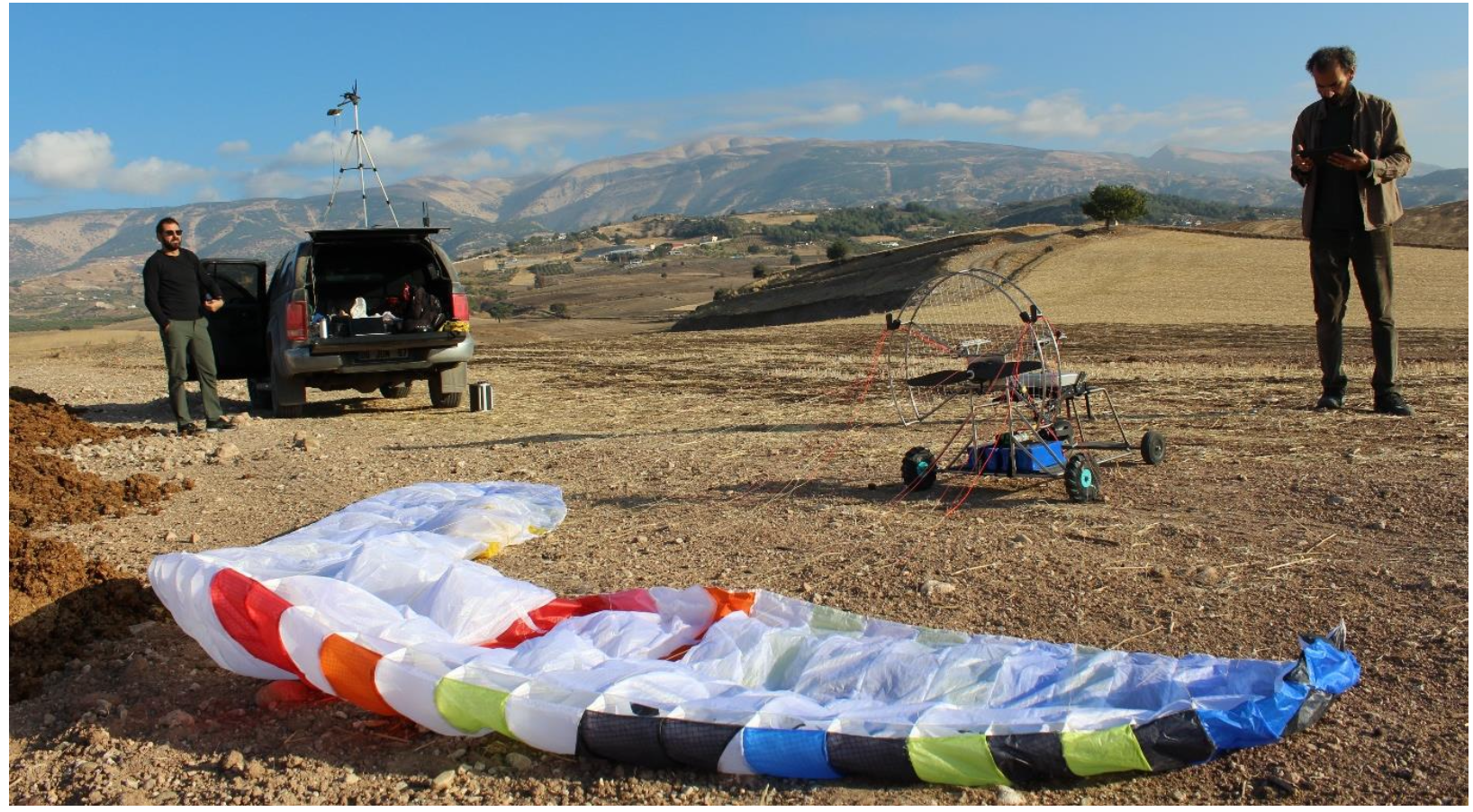
Parafoil Drones: A Game-Changing Technology: Parafoil drones emerged as a groundbreaking solution for tracking large areas, covering up to 10 square kilometers in a single flight—an accomplishment regular drones couldn't match due to their limited flight time. These unmanned aerial vehicles proved crucial in addressing the illegal debris dumping issue faced by municipalities.

By participating in various related meetings around earthquake recovery efforts and holding regular research and communication with the innovation ecosystem, the United Nations Development Programme Türkiye Accelerator Lab (UNDP Türkiye AccLab) met the company “Innovita Technology”, the forefront provider of parafoil unmanned aerial vehicles in Türkiye. Although there are many areas in whichparafoil drones can be used, AccLab came up with the added value of this technology to recovey efforts. Innovita's product, Junno, stood out for its state-of-the-art autonomous flight technology, allowing precision in navigation and execution of flight plans with minimal human intervention. The Junno drone promises a range of applications, from surveillance to data collection, making it an ideal choice for efficient debris tracking.
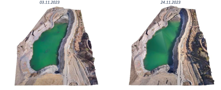
AccLab collaborated with Innovita Technology and Kahramanmaraş Metropolitan Municipality to conduct two surveillance flights at the Kahramanmaraş dump site. This initiative aimed to not only track debris but also provide comprehensive analyses for informed decision-making. Themunicipality is now using the raw data, the photos and the analyses to understand the capacity of the area, and when they should be directing the debris to other sites before it becomes saturated.

Empowering Municipalities for the Future: The study not only showcased the effectiveness of parafoil drones but also paved the way for future collaborations between municipalities and technology providers. The municipality's enthusiasm to adopt this technology hints at the potential for local governments to independently own and operate similar drones for enhanced tracking capabilities.
The autonomy and capabilities of parafoil drones open up opportunities for various applications, including environmental monitoring, agricultural studies, and even emergency response scenarios.

Future Prospects and Opportunities: The successful parafoil drone pilot study not only addressed immediate challenges but also laid the groundwork for future projects. Key areas for future exploration include environment-friendly debris management, establishing a holistic Debris Management System, and feasibility studies for agricultural monitoring in earthquake-prone regions.
As we navigate the aftermath of the earthquake in Türkiye, parafoil drones stand out as a beacon of hope for efficient debris tracking and management. The collaboration between UNDP Türkiye AccLab, Innovita Technology, and the local municipality exemplifies the potential for innovative technologies to shape the future of disaster response and recovery.

 Locations