
 Locations
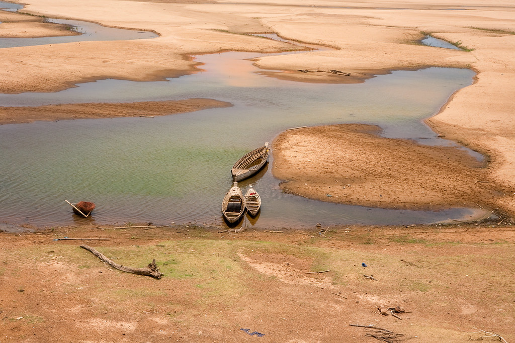
The Mekong river is very low at the end of the dry season. Prek Ta Am Village; Bos Learv Commune; Jit Borey district. Photo credit: UNDP Cambodia/Arantxa Cedillo
Between 1987 and 2017, there were six major drought events recorded in Cambodia. According to the International Disasters Database these events impacted a cumulative total of 8.5 million Cambodians – a majority of whom depend on agriculture for their livelihood.
Traditional practices are being challenged by increasingly rapid changes in climate. Consequently, one of the major challenges of slow-onset droughts is a lack of indicators; that is, at what point a lack of water is considered a drought.
In order to address this question and the high toll of climatological events such as droughts, indicators need to be clearly identified and understood, as well as the impacts of such events – both of which have been historically limited in Cambodia.
A recent report released by the United Nations Development Programme (UNDP) is hoping to address the issues by commissioning a National Drought Study under the project, ‘Strengthening Climate Information and Early Warning Systems in Cambodia’, funded by the Global Environment Facility-Least Developed Countries Fund.
The study looks at droughts from a number of perspectives, including historical trends and indicators as well as potential future approaches.
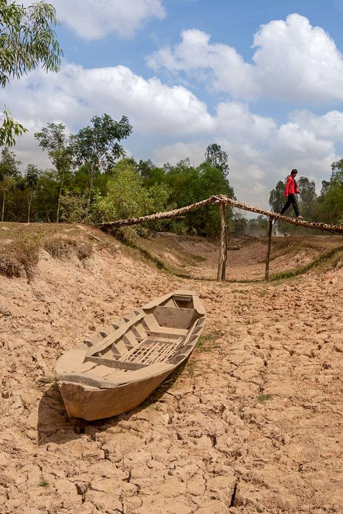
Despite the prevalence of droughts in Cambodia, a lack of information presents ongoing issues. Photo credit: UNDP Cambodia/Arantxa Cedillo
It is often presumed that drought is simply a lack of rainfall, however the study challenges this assumption: “Assuming that total annual rainfall and drought are highly associated, meaning that the less the rainfall in a given year, the more the drought impacts, then, data does not really allow establishing this relationship except the extreme meteorological drought as in 2004 in some provinces. For example, Kampong Speu province experienced the most severe damage on paddy production in 2004 at 38,257 hectares (ha) of area cultivated and received total rainfall at 921 millimeters (mm). However, the least rainfall was not in 2004 but in 1997 at 770 mm and damaged on cultivated area at 14,962 ha.”
As a result, it is clear that the amount of annual rainfall (or lack of) does not necessarily equate to a drought.
Indicators need to be developed which consider this discrepancy, as well as the country context and four types of drought acknowledged in current literature (meteorological, agricultural, hydrological and socio-economic).
Each type of drought is measured using different approaches, making it challenging to find a universal definition and measure. For example, meteorological drought is considered to be a ‘precipitation deficit’ that can be measured using the Standardized Precipitation Index (SPI), whereas a hydrological drought refers to a lack of water sources (including surface water, ground water, streams etc.) and is commonly measured using a Normalized Difference Water Index (NDWI).
None of these individual measurement systems can universally show when a drought has occurred, nor do they explain what the impacts of the drought event were. They can, however, help identify the specific type of drought, when it occurred in the season (early-, mid-, or late-season drought), as well as provinces that may be particularly vulnerable to drought areas of the country which may require particular attention.
The study therefore proposes indicators, such as considering the amount of rainfall in any given wet season as opposed to using only the annual amount as well as other approaches such as soil moisture (using remotely sensing data), and surface water and ground water level as an indicator to identify drought onset.
Even once indicators have been established, they need to have localized thresholds in order to address differences between localities. It is also emphasised that overall, one’s adaptive capacity to respond to droughts will remain a significant factor; people who experience the same natural hazard will be impacted differently according to their preparedness and resilience, thus emphasizing the importance of establishing indicators which allow for effective drought-related early warning systems.
The report is not UNDP’s only involvement in addressing the issues raised by drought. DanChurchAid and UNDP have been working together to develop Drought InfoHubs, as well as to understand community perceptions of droughts in order to interweave these ‘drought trigger points’ into indicators to allow slow-on disasters to be managed and risks reduced effectively.
For example, in Takeo, the proposed drought trigger points that must exist for a hydrological drought is having water reservoirs of less than 20%, while the proposed trigger point for agricultural drought is more than 60% of rice seedlings being dry.
DanChurchAid currently have established these trigger points for Kampong Speu, Takeo and Kampot, with more currently being developed for Kampong Chhnang, Pursat and Battambang. DanChurchAid have also facilitated the ongoing Drought Resistant Agricultural Techniques (DRAT) training, which has engaged farmers across several provinces with adaptive farming methods designed to enhance their resilience during droughts.
It is hoped that the report supports establishment of relevant Early Warning Systems (EWS) for drought that are adapted to the needs of the Cambodian context and people.
Written by Kelsea Clingeleffer, International Results Monitoring Consultant
For more information contact Muhibuddin Usamah (Project Manager) at muhibuddin.usamah@undp.org
See the ‘Strengthening Climate Information and Early Warning Systems in Cambodia’ project twitter images here.
For updates on this project and UNDP Cambodia’s broader work, follow @UNDPCambodia on Facebook, Twitter and LinkedIn


