
 Locations
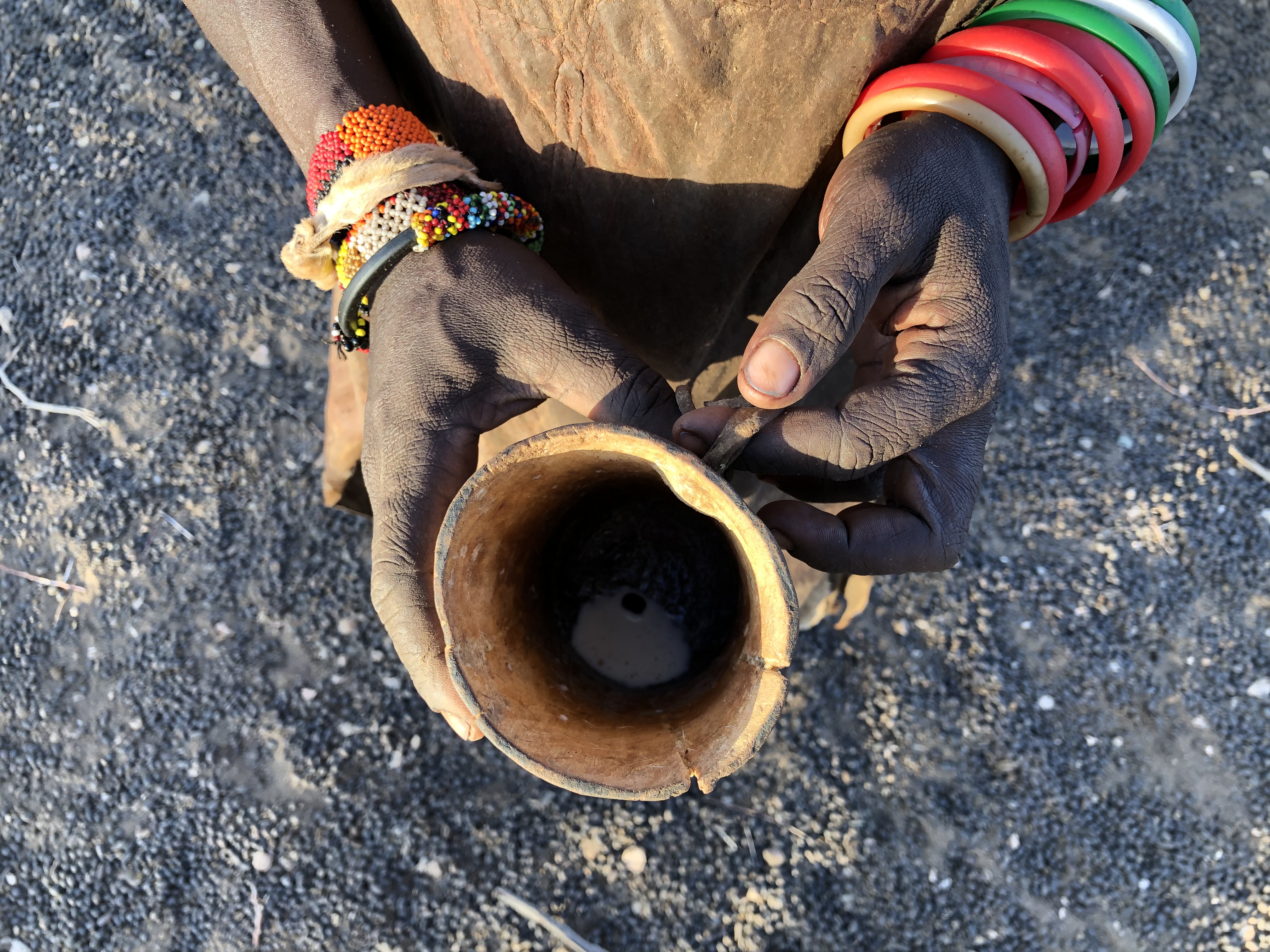
Rebeca Nakapun holding a wooden cup after milking 20 goats. Turkana County, Kenya. Photo: Anna Moghilda.
The above photo shows how much milk a mother of 6 children could get from 20 goats. It was back in February 2019 during the dry season, in the northern part of Kenya, albeit the drought spells replicate annually.
For a significant population of the Horn of Africa, pastoralism and agropastoral livelihood represent a critical and a main way of life and income to survive and support own families. The seasonal mobility of own livestock, mostly cattle, sheep, goats and camels, is an inherent way to pastoralists - they move their animals in search of water and pasture when there are no longer available in their inhabited areas.
In addition to this, pastoral communities experience restriction on mobility of their cattle, conflicts and stricter cross-border control that produce threats to tenability of pastoral livelihood.
In order to address these challenges and protect pastoral ecosystem, under the Support for Effective Cooperation and Coordination of Cross-border Initiatives in Southwest Ethiopia – Northwest Kenya, Marsabit – Borana and Dawa, and Kenya – Somalia – Ethiopia (SECCCI) EU co-funded Project, the Intergovernmental Authority on Development (IGAD) has been leading consultations to adopt a protocol on transhumance that will facilitate safe regulated livestock cross-border mobility in the region.
The seasonal livestock migration existed for hundreds or even for thousands of years as a survival strategy for the pastorals although there were no officially documented livestock routes. Hence, the Project initiated the identification of priory routes along Ethiopian and Kenyan border and engaged stakeholders for a participatory mapping session.
"If the road is not identified, if the resources are not identified, during the migration of livestock, the pastoralists do not know where to get the water and pasture for their livestock that is due to die because of starvation, diseases, drought, and this (map) may solve all these problems." Dr. Buyu Kanchora, Head of livestock resources of Borana zone, Ethiopia.
65 stakeholders, primary community elders from the major tribes of southern Ethiopia and northern Kenya, and technical experts on livestock production, water and rangelands worked in two separate participatory mapping sessions for each side of the border. For the northern part of Kenya, the participants met in Marsabit town and for the southern Ethiopia, the mapping session was organized in Moyale town.
The groups were constituted based on familiarity of the area while respecting the prevailing dynamics of the clans. After collecting information from sketch maps of local tribes’ leaders of the two countries, data was harmonized and analyzed into Geographical Information System for a friendly use.
Furthermore, all stakeholders jointly identified key investments ranging from water accessibility, rangeland interventions, livelihood support and basic social services.
A final validation and harmonization meeting was held with cross border communities and stakeholders where 20 interlinked intra and cross border routes were jointly prioritized as transhumance routes along Kenya and Ethiopia border.
These transhumance routes act as conduits of investments that can be channeled to promote and enhance the livelihoods of local communities, mobile pastoral population, watering, grazing and accessibility to social amenities.
"The mapping is very important, this has been there from the time of immemorial to the best of my knowledge this route has been known to me since 1840, my grandfather uses the same, my father uses the same, I am using the same. This is our lifestyle since the time of immemorial and mapping exposes support to the pastoral communities along the Kenyan and Ethiopian border."- Tomal Ortolgalpete, Gabra elder, pastoralist from northern Kenya, peacebuilder.
For the national and local governments, development partners, local NGOs the transhumance routes will act as a baseline documentation by receiving information on the livestock move and identified watering points, border entry points, encampment points, conflict hot spots, health and education facilities etc. along the identified corridors.
As well, the developed maps represent a useful source for conflicts early warnings and mitigation measures and will support corridor development initiatives as a means of promoting and enhancing resilience of the cross border agro-pastoralists and pastoralists.
The SECCCI Project is funded by the European Union Emergency Trust Fund for Africa (EUTF), co-funded by the UN, and implemented by UN Development Programme (UNDP) Regional Service Centre for Africa (RSCA), IGAD and UN Environment Programme (UNEP).
The Transhumance route - showing how the livestock moves in search of water and pastor, along Ethiopian – Kenyan border developed by SECCCI EU co-funded Project


