
 Locations
Belarus has recently launched an online map showcasing all specially protected natural areas, marking a significant milestone in country's conservation efforts. The digital platform serves as a comprehensive hub for eco-tourism, inviting tourists to explore Belarus' diverse natural treasures.
Belarus Unveils First Online Map of All Protected Nature Areas
April 16, 2024
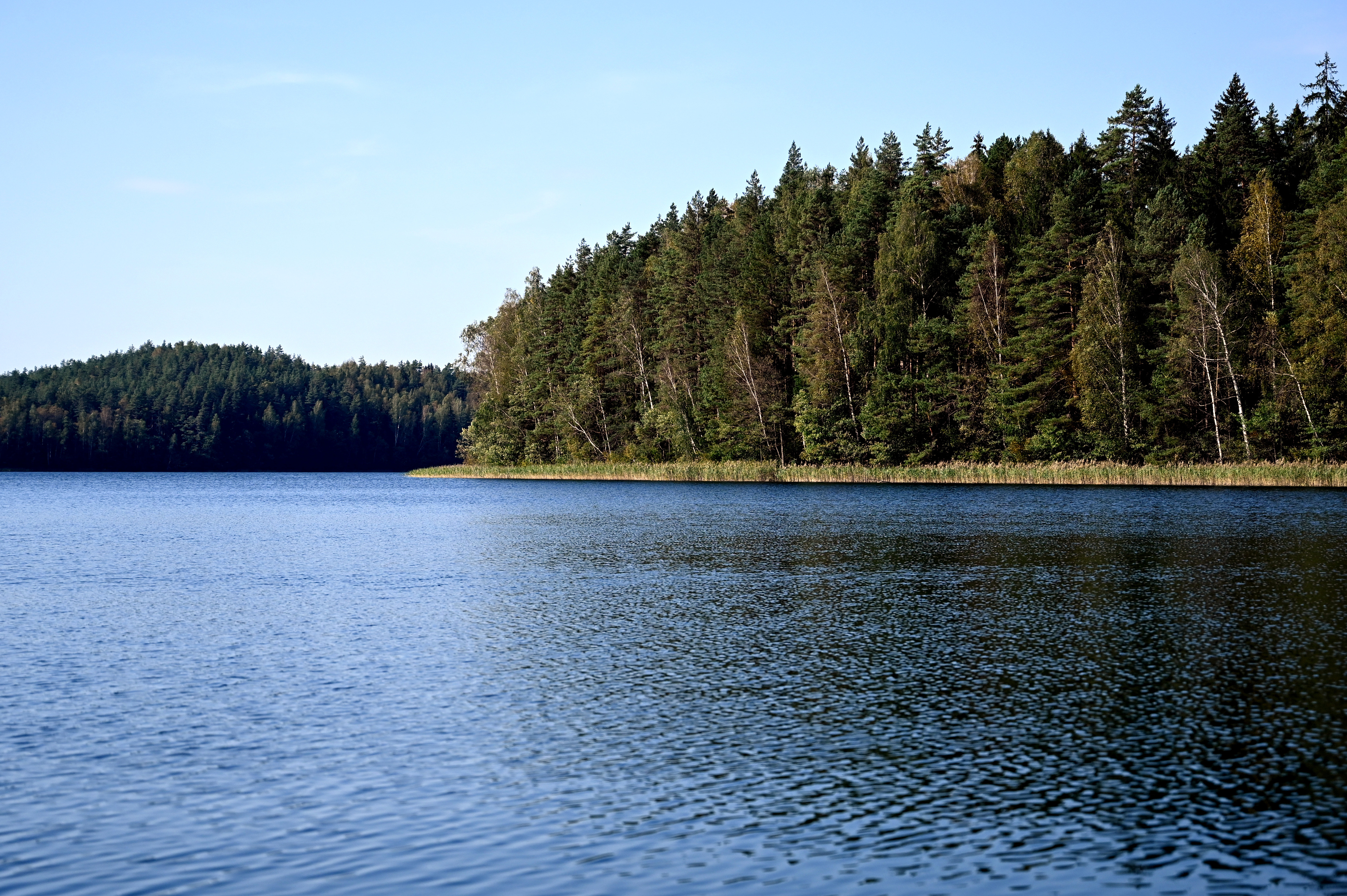
Golubyye ozera, a nature reserve in the Grodno region
Photo credit: UNDP in Belarus
With 1,354 sites under protection, Belarus boasts a rich natural heritage. The protected landscapes cover 9,1% of the country’s territory and make prime destinations for ecotourism.
Now, with the help of the new interactive map that meticulously details all natural parks, reserves, and natural monuments in the country, one can discover the diversity of Belarusian nature online.
A robust system of conservation in Belarus includes one nature reserve, four national parks, 374 wildlife sanctuaries, and 969 natural monuments. These protected landscapes cover 1.9 million hectares (19,000 km2), or 9.1% of the country’s total area.
Who will find the map useful?
The new digital resource will empower users to effortlessly access all essential details about the protected areas, facilitating trip planning and enhancing the overall visitor experience.
Conveniently, there are GPS coordinates for each nature site marked on the map. Equipped with practical tools like a distance calculator and route planner, tourists can customize their trips based on personal preferences and logistical considerations.
When planning a vacation in reserves and national parks, tourists will be able to find information about ecotourism services available: route options, tours, and equipment rental. In addition, the map features contact information and links to online resources that could come in useful when studying accommodation options or making a list of cultural attractions to visit in the area.
Yet, one does not need to travel far to connect with nature. The map lists almost a thousand natural monuments, often hidden in plain sight: picturesque groves, centuries-old oaks, and picturesque lakes.
Among unusual destinations, the tourists may find, for example, the habitat of the elusive speckled ground squirrel or the wintering site of bats. No less exciting sounds the opportunity to enjoy the stunning scenery of Belarus' largest lake or discover mysterious Belarusian ‘fjords.’
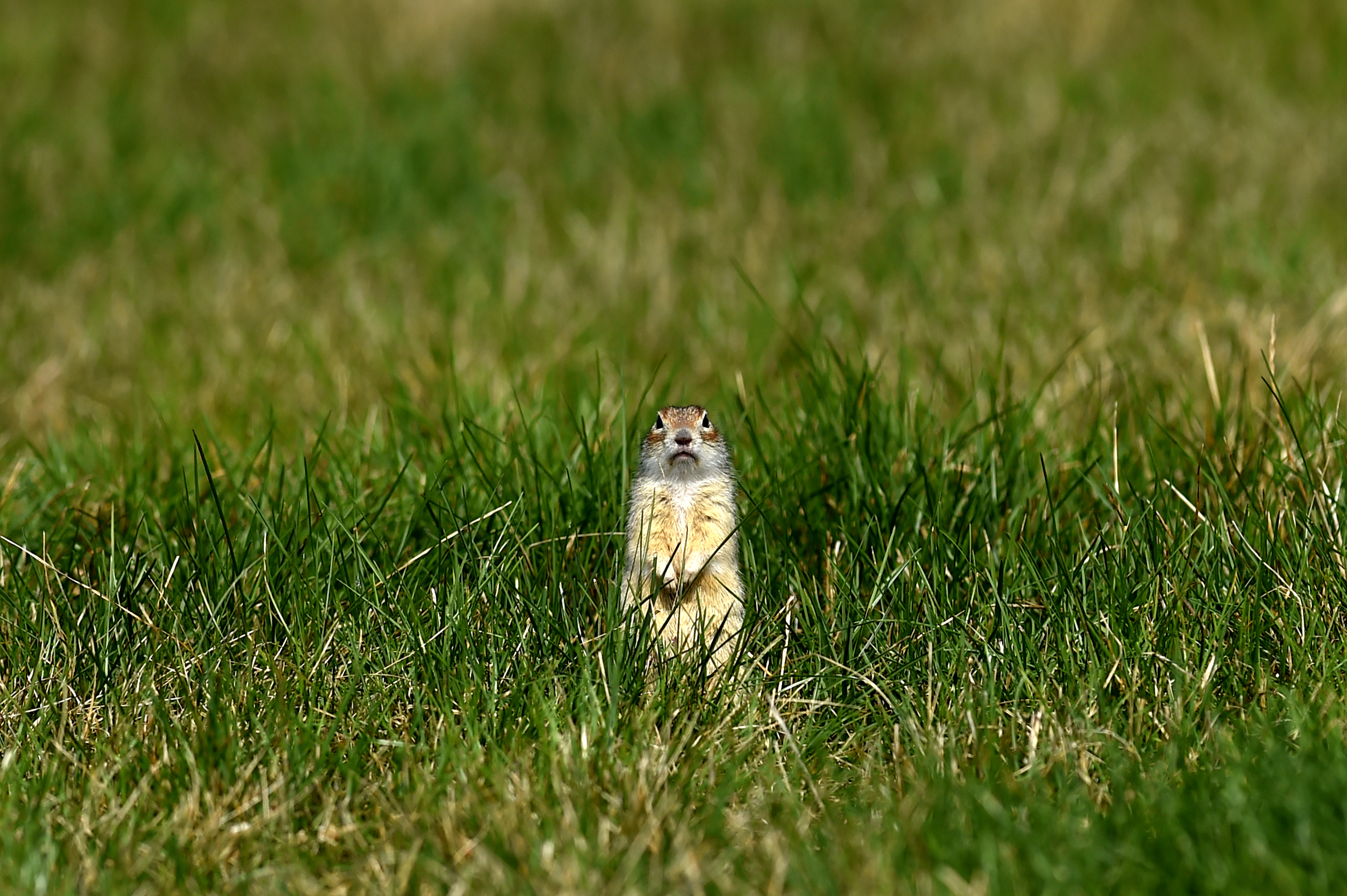
A spotted souslik is an endangered species listed in the Red Book of Belarus. One of the few surviving colonies lives in the Rakitnik nature reserve, the territory and purpose of which were changed to protect these special animals.
Photo credit: UNDP in Belarus
Is it just a matter of convenience?
The role of digital technologies in wildlife conservation is becoming increasingly important. Following the Digital Strategy 2.0 and the Strategic Plan 2022-2025, the United Nations Development Program (UNDP) supports countries in their green and digital transformation.
Thus, thanks to GPS, photo traps, satellite transmitters and other digital surveillance systems, we can monitor rare and endangered species to then develop solutions for preserving and increasing threatened populations of plants and animals.
The digital map of specially protected nature areas will become another important tool for biodiversity conservation and will contribute to disseminating knowledge about the environment. The resource pays particular attention to detailing rare and endangered species in each area. Threatened with extinction, many of them have been in included in the new edition of the Red Book of Belarus, the layout of which was prepared with the support of UNDP. Such an integrated approach will not only improve the overall planning experience but importantly also increase tourists’ environmental awareness.
The maps can also be additionally used to develop new ecotourism routes and products, as well as ensure sustainable management of protected natural areas. Ultimately, all these efforts are an important step towards preserving the natural heritage of Belarus.
The digital map was created within the Development of Eco-Tourism to Promote a Green Transition to Inclusive and Sustainable Growth project, implemented by UNDP in partnership with the Ministry of Natural Resources and Environmental Protection of the Republic of Belarus with financial support from the Russian Federation.
Related
content
content


