
 Locations
Kampala – Monday, 21 December 2020. As part of their mission to protect, manage, and restore areas critical for human life and biodiversity, the National Environment Management Authority (NEMA) and the United Nations Development Programme (UNDP) have released second phase results of “Mapping Nature for People and Planet in Uganda”, a project identifying the country’s Essential Life Support Areas (ELSAs).
“The Essential Life Support Area map produced for Uganda identifies areas for collaboration to protect, manage, and restore nature to best deliver across the 13 priority targets for the country,” explained UNDP’s Deputy Resident Representative, adding that that the tool will contribute to the realization the country’s development aspirations enshrined in the third National Development Plan (NDPIII), Uganda’s long term Vision 2040 and UNDP’s new Country Programme premised on partnership and cooperation in this decade of action. “It is a tool that can foster continued discussions about where action can be taken based to advance development priorities.”
ELSAs are areas essential for conserving critical biodiversity and providing humans with essential ecosystem resources, such as carbon storage, food, fresh water, water filtration, and disaster risk reduction.
By using this tool to process geospatial data, Uganda applies rigorous scientific methods to identify ELSAs based on national priorities and set specific objectives for their protection, management and restoration. This is one way that the country is working to further national and international commitments to the Convention on Biological Diversity and the 2030 Agenda for Sustainable Development.
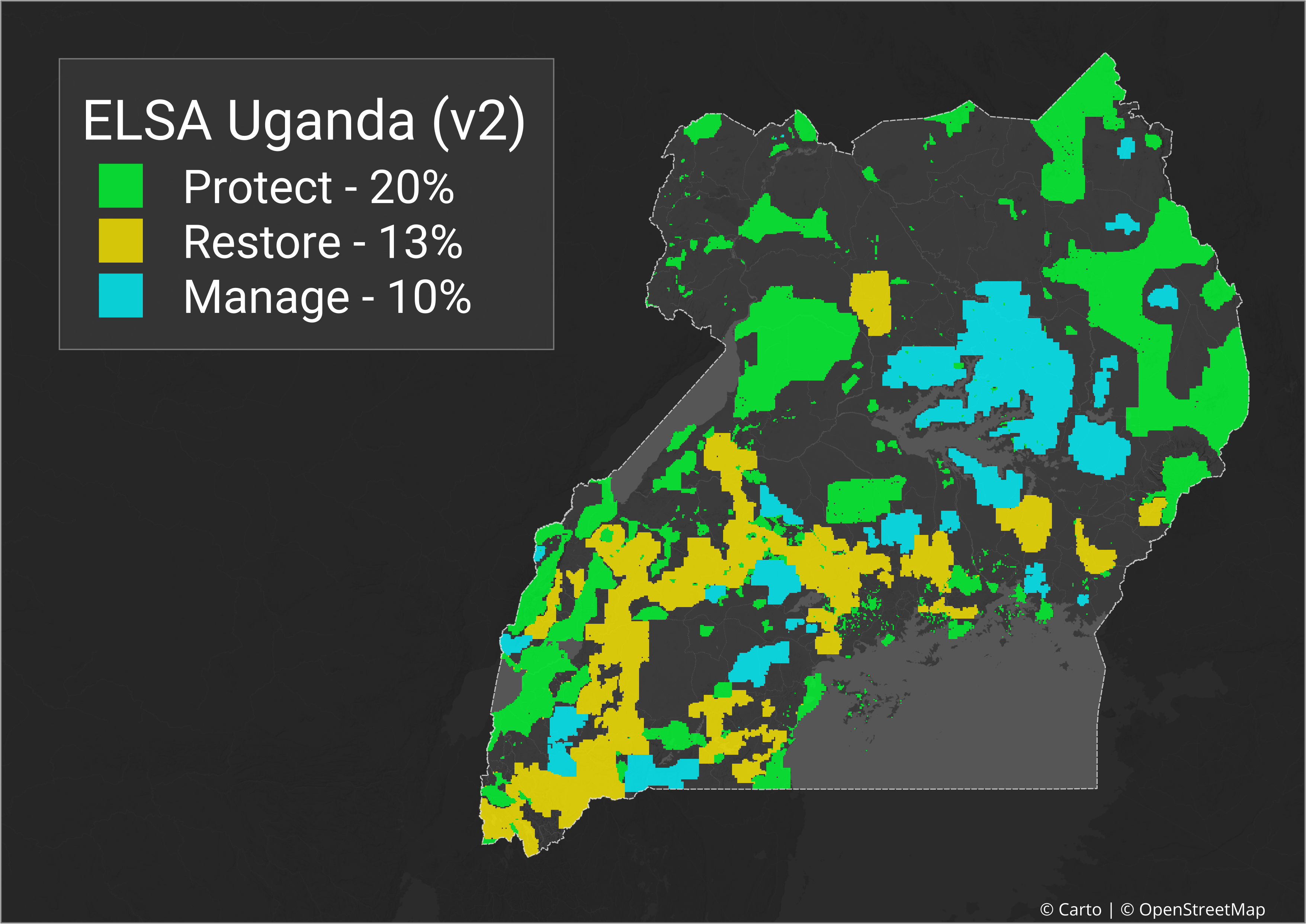
Image: The Essential Life Support Area (ELSA) map for Uganda
“Uganda is home to over 18,000 species of flora and fauna. By taking part in Mapping Nature for People and Planet, we are demonstrating our conscience and commitment towards protecting the ecosystems that are home to this diversity of species. As a country, Uganda is determined to create and maintain conditions that will allow biodiversity to thrive. Conservation of nature and development objectives are often falsely considered to have conflicting objectives, however these two are linked and it is possible to have development alongside healthy ecosystems and that is our ultimate goal,” remarked Dr Tom Okurut, Executive Director of NEMA.
During the second workshop, stakeholders from across Uganda co-created the second iteration of the country's map of ELSAs in real-time. This exercise is one of the first of its kind globally, noteworthy for the live engagement of national experts and scientists to develop a map that reflects national priorities and realities. This second phase also contributed to building Uganda’s capacities to take ownership of the project through the leadership of national institutions.
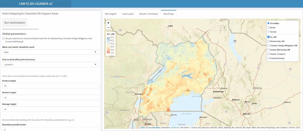
Image: Stakeholders co-creating the ELSA map in real-time during the second workshop.
Armed with these second phase results, work on the project will explore how the tool and final maps can support the implementation of key projects in Uganda, such as restoring wetlands and protecting endangered species.
The work underway in Uganda is inspiring similar initiatives in other countries committed to identifying their Essential Life Support Areas, including Costa Rica, Colombia, Kazakhstan, and Peru.
Background
Uganda embarked on the first phase of this project in January 2020, with a proof-of-concept study reviewed by national experts at a workshop held in May and June 2020. Through active involvement of diverse national and international stakeholders, the workshop led to the selection of 13 priority targets for Uganda on nature, climate change, and sustainable development that the ELSA map will chart a pathway to achieve. The workshop likewise identified national spatial datasets that were used to strengthen the robustness of the map in the second phase of the project. The official report from the first workshop can be accessed here.
The project has attracted wide participation from the environment and agriculture sectors and from other key national institutions involved in land use planning and technology-assisted decision making. Workshop attendees included representatives from NEMA as well as international organizations with delegates from UNDP, the National Geographical Society, the University of Northern British Columbia, PacMARA, and more. This project was made possible by financial support from the Global Environmental Facility and the Gordon and Betty Moore Foundation.


