
 Locations
While reflecting on the new methodology designed by the United Nations Development Programme (UNDP) Uganda Accelerator Lab team to dissect deforestation in Uganda, we found ourselves asking “If there are so many people planting trees and exploring alternatives to biomass energy, why does this problem persist?”. According to the Ministry of Water and Environment, Uganda’s forest cover has declined from 24% in 1990 to just 8% 2018, and with the decline continuing at its present rate, Uganda risks being without any forest cover by 2040. Considering our call for solutions to address deforestation generated over 200 responses, we came to question how rates of deforestation could be increasing while so many are working toward reversing this issue.
For starters, the UNDP Uganda Accelerator Lab team is undertaking a portfolio of experiments relating to deforestation, born from several exploration methodologies used to identify key priorities for intervention. The experiment in question within this particular blog seeks to determine the potential for a real time data visualization platform to transform forest management in Uganda.
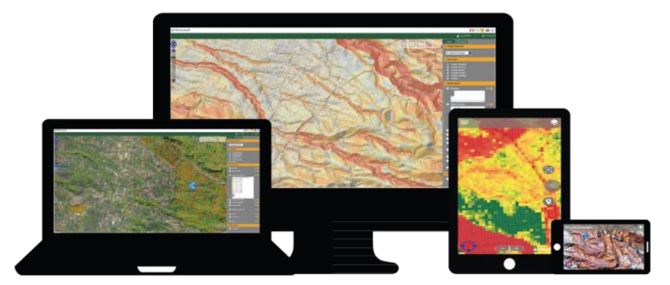
Image: Data Visualization Platform interfaces
Data Visualization Platform
Drawing from intensive activities conducted to identify leading drivers of deforestation in Uganda, the Accelerator Lab team found a gap in recent data dating back to 2016. The team concluded that enabling access to real time data would trigger success in driving action from key stakeholders and generating a more coordinated approach to reversing rates of deforestation.
Recognizing the gap in recent data to track rates of deforestation in Uganda, and quantify the impact of initiatives to combat the vice, the Accelerator Lab team saw an opportunity to harness technology and tap into new data sources, embarking on an experiment to design a real time data visualization platform with capacity to track countrywide efforts in forest management.
With the National Forest Authority (NFA) and Oy Arbonaut Ltd on board as implementing partners, we sought to better understand how real time data can influence decision making of stakeholders relating to deforestation in Uganda.
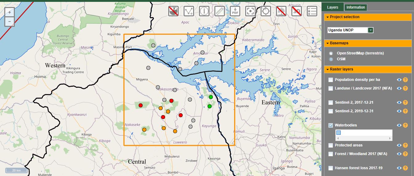
Image: the Data Visualization Platform web user interface
Together with the NFA, who were involved in this initiative from sense making to design, we designed the platform with the following key features.
i) A web user interface that incorporates a geographic information system (GIS) with an old landcover map of Uganda provided by NFA as the baseline.
ii) A mobile application to assist with field monitoring and validating information gathered from satellite imagery.
iii) The ability to track changes in forest cover over time and validate field actions through the mobile interface.
iv) The ability to be used both online and offline, with data syncing once back online.
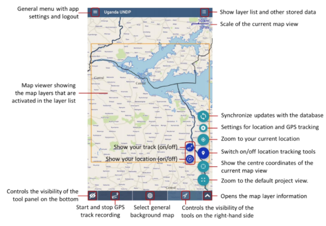
Image: the Data Visualization Platform mobile interface
“We are very pleased with the outcome and excited about the possibilities it offers in forest management for Uganda,” noted Mr. Stephen Galima of the NFA, whose team is currently conducting user tests and training in order to ensure an element of user-led design within the platform. The Accelerator Lab team believes that this approach will on completion ensure higher rates of platform use by the end users.
“I like the fact that it enabled us to produce deforestation layers by ourselves,” added Mr. John Diisi, GIS expert at NFA. “It’s integration to the Google Earth engine with such enormous computing power and the readily available high resolution Sentinel satellite data makes us even more eager to start using the system.”
“The mobile app of this system is excellent,” Mr. Dissi said. “Its ability to work both online and offline will ease the work of our field staff when out in the forests ground truthing.”
Beyond Forest Management
As we conduct user testing, we are learning of the platform’s capacity for use beyond simply monitoring of forest cover loss in Uganda. There is also potential to understand migration patterns over time, track urban development and inform urban planning. We hope to explore these use cases further with the goal of ensuring the sustainability of the platform.
Looking ahead, our plan is to launch this platform in late 2020 and share it widely with stakeholders involved in the initial exploratory work. We also hope to map out how this information has impacted the design and execution of initiatives to combat deforestation. Over time, we hope to utilize this platform in various ways, with improved capabilities to serve Uganda for forest management and beyond.
Partnerships are key to the success of this platform and we invite any prospective partners interested in this initiative to reach out to us at:
Berna Mugema, Head of Experimentation, Berna.mugema@undp.org
Deborah Naatujuna, Head of Exploration, Deborah.naatujuna@undp.org
Hadijah Nabbale, Head of Solutions Mapping, Hadijah.nabbale@undp.org


